File:Map of Tequilapoli.png
Revision as of 13:15, 20 March 2018 by Navybrat85 (talk | contribs)
No higher resolution available.
Map_of_Tequilapoli.png (503 × 419 pixels, file size: 15 KB, MIME type: image/png)
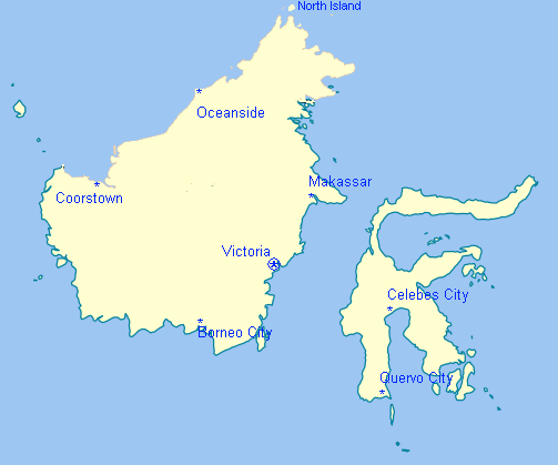
Map of Tequilapolian Islands. Excludes islands in the region not owned by Tequilapoli.
File history
Click on a date/time to view the file as it appeared at that time.
| Date/Time | Thumbnail | Dimensions | User | Comment | |
|---|---|---|---|---|---|
| current | 17:04, 8 February 2018 | | 503 × 419 (15 KB) | Navybrat85 (talk | contribs) | Map of Tequilapolian Islands. Excludes islands in the region not owned by Tequilapoli. Category:Maps |
- You cannot overwrite this file.
File usage
The following 3 pages link to this file:
- Tequilapoli
- File:Tequilapoli map.png (file redirect)